
Uncategorized
Crater Peak, a peak without a peek of Crater Lake
he name Crater Peak is misleading. The views from its summit are broad, sweeping and expansive, but Crater Peak doesn’t offer even a peek at Crater Lake.
Unlike Crater Lake, which is a body of water in a caldera, Crater Peak is an actual crater. Located in the south zone of Crater Lake National Park, the peak reaches an elevation of 7,263 feet, which is actually lower than the highest viewpoint along Rim Drive.
But that doesn’t detract from the charm, or the views, that reward hikers making the 7-mile round-trip trek.
Crater Peak’s summit crater is the rounded remains of an ancient shield volcano. According to a park interpretive sign, Crater Peak is the largest of several small volcanoes, or cinder cones, associated with Mount Mazama.
A half-mile trail rings around the summit, which is little more than an uneven bowl that geologists say was partially filled by pumice and ash from Mount Mazama’s eruption 7,700 years ago.
The summit is an area of contrasts. A large portion of the final loop climbs through a grassy meadow, a surprisingly lush shade of green. But, as it gently gains elevation, the trail is sprinkled with wildflowers. At its highest, clearings reveal sightings of Mount Shasta, Union Peak, Mount McLoughlin, Garfield Peak, Upper Klamath Lake and Mount Scott.
The Crater Peak Trail begins off East Rim Drive, 14 miles east of park headquarters at the well-signed Vidae Falls Picnic Area.
The trail starts gently, passing through a meadow made lush by bucolic Vidae Creek. In about a half-mile it climbs a rocky, huff-and-puff zigzag route up a scree slope, eventually paralleling East Rim Drive before gently weaving along a broad ridge lined with mountain hemlock and Shasta red fir along with scarlet gilia, lupine and other wildflowers.
Two members of our hiking group, Mike Book and Dennis Vander Schaaf, paused long enough to slice a fallen tree blocking the trail. Dennis used a small portable hand saw while Mike used a “chain” saw — not the mechanical kind but a bicycle-like chain with edges sharp enough to rip through the dead wood.
The trail was mostly clear, so there was little to saw and much to see.
As the trail began its final steep, winding climb to Crater Peak’s rim, we saw westward through-the-tree views of Union Peak and portions of East Rim Drive.
Something we never saw, and are seldom seen, were crowds.
Unlike other park trails that are commonly teeming with hikers, the lesser known Crater Peak Trail is little traveled. That’s partly because it is a challenging hike. Descriptions from various trail guides, which calculate the elevation gain as somewhere between 765 and and 1,519 feet. (Variations are common because some measure only the change in elevation between the trailhead and the summit, while others include some or all of the ups and downs along a trail.)
It’s also less traveled because, unlike the three other trails in the park that lead to summits – Garfield Peak, The Watchman and Mount Scott – the Crater Peak Trail offers no peek-a-boo views of Crater Lake.
But even without that view, it’s a hike that is a peak experience.
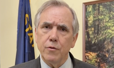

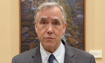
Oregon Sen. Merkley responds after President Trump approves Saudi nuclear deal, says “this reckless move could fuel a nuclear arms race that puts all of us at risk”
Oregon – Trump is gifting Saudi Arabia the capability to pursue a nuclear weapon,” Oregon Sen. Jeff Merkley said as...
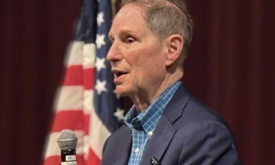

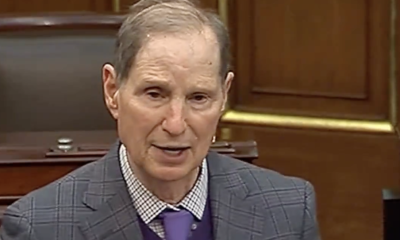
Oregon Sen. Wyden says President Trump has “abused his power” unlike any other president, claims his bill will put Congress back in control of international trade
Eugene, OR – “Trump has abused his power on tariffs and trade unlike any other president,” Oregon Sen. Ron Wyden said as...


“President Trump is doing what he does best,” Oregon Gov. Kotek responds after President Trump imposed tariffs she says hurt Oregon families and businesses
Oregon – “President Trump is doing what he does best: driving up costs for families and hurting Oregon businesses that...


Oregon State Police and FBI investigate after individuals identifying themselves as “ICE” allegedly forced victim from vehicle before detaining and assaulting them
Eugene, OR – The Oregon State Police and the Federal Bureau of Investigation are investigating a report of individuals impersonating...
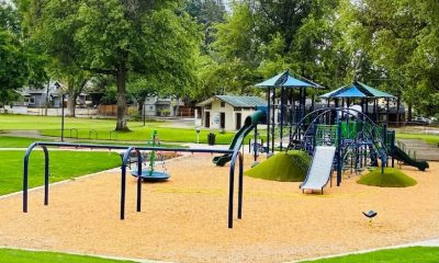

University Park reopens in Eugene with improved facilities, playground and accessibility upgrades
Eugene, OR – The City of Eugene announced that the renovation of University Park has been completed, with the 2.81-acre...


Eugene Springfield Fire crews return from wildfire deployment in Oregon
Eugene, OR – Several members of Eugene Springfield Fire have returned home after assisting with wildfire response efforts in Oregon....
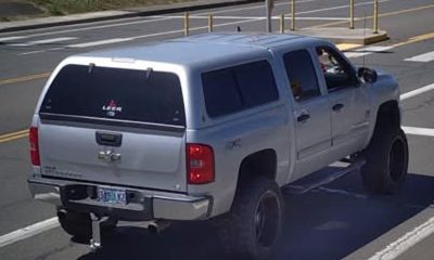

Eugene Police seek public help locating stolen truck involved in hit-and-run crash with bicyclist
Eugene, OR – The Eugene Police Department is asking for the public’s assistance in locating a stolen pickup truck investigators...


25-year-old woman arrested after flooding apartment and damaging neighbor’s property in Eugene
Eugene, OR – A 25-year-old woman was arrested after Eugene Police said she flooded her apartment, broke a neighbor’s window,...

“Trump can’t accept that he lost his case, so now he’s asking the Supreme Court for a re-do until he wins,” Oregon Sen. Merkley responds after Trump seeks rehearing in birthright citizenship case
Oregon – Oregon Sen. Jeff Merkley criticized President Donald Trump after Trump announced he would ask the U.S. Supreme Court...

Oregon Sen. Wyden joins Senate Democrats demanding answers over whether Trump family-linked companies could benefit from DOJ settlement
Oregon – Oregon Sen. Ron Wyden is joining fellow Democratic senators in raising questions about whether companies connected to President...
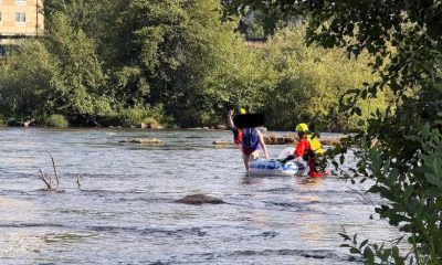

Eugene Springfield Fire rescues person trapped in Willamette River low head dam near I-5 bridge
Eugene, OR – Eugene Springfield Fire crews responded to a water rescue on the Willamette River in Springfield’s Glenwood neighborhood...
-
Eugene6 days ago
Eugene Springfield Fire crews return from wildfire deployment in Oregon
-
Oregon6 days ago
“President Trump is doing what he does best,” Oregon Gov. Kotek responds after President Trump imposed tariffs she says hurt Oregon families and businesses
-
Oregon6 days ago
Oregon Sen. Merkley responds after President Trump approves Saudi nuclear deal, says “this reckless move could fuel a nuclear arms race that puts all of us at risk”
-
Oregon6 days ago
Oregon State Police and FBI investigate after individuals identifying themselves as “ICE” allegedly forced victim from vehicle before detaining and assaulting them
-
Oregon6 days ago
Oregon Sen. Wyden says President Trump has “abused his power” unlike any other president, claims his bill will put Congress back in control of international trade
-
Eugene6 days ago
Eugene Police seek public help locating stolen truck involved in hit-and-run crash with bicyclist
-
Eugene6 days ago
25-year-old woman arrested after flooding apartment and damaging neighbor’s property in Eugene
-
Eugene6 days ago
University Park reopens in Eugene with improved facilities, playground and accessibility upgrades